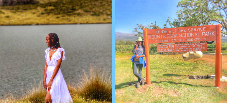
We left Nairobi at 4:30 am for our Lake Ellis Mt Kenya Hike and arrived at Chogoria at around 9:30 am. Mt Kenya is beautiful. At the KWS offices, you can see the mountain in all its glory. Although you can’t see the peaks until you hike to Lake Michaelson, it’s a wonderful place.
The base offers lots of neat places to have a picnic. The air is lighter and the birds in Mount Kenya are so round and plump. They also don’t fear people and expect you to feed them. I think lots of people camping at Mount Kenya have fed them.
Table of Contents
QUICK FACTS ABOUT LAKE ELLIS, MT KENYA
Difficulty: Moderate
Trail Length: 14 KM
Weather: Sunny and dry.
Hiking Duration: Around 4 to 6 hours
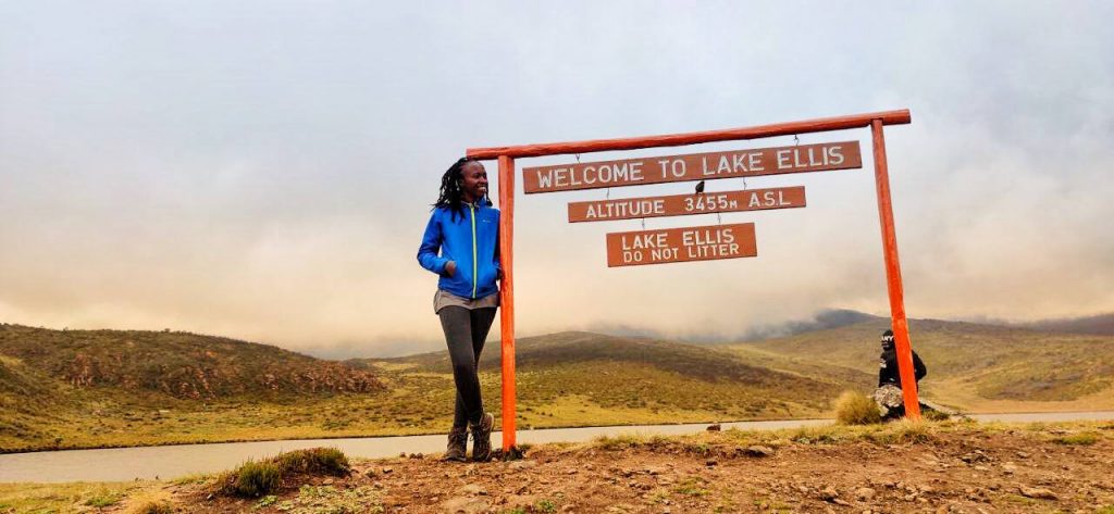
Elevation: Chogoria gate stands at 2,950 M while Lake Ellis can be found at 3,455M ASL. This makes it a 505M ASL.
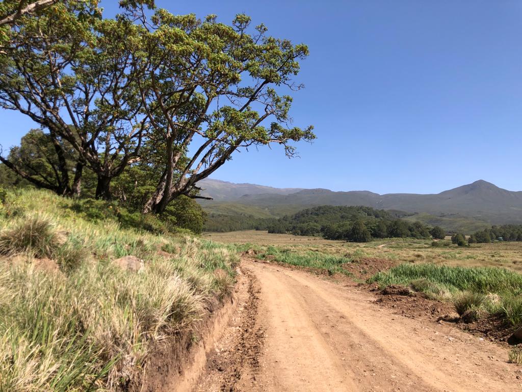
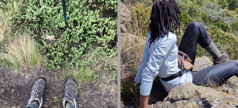
The Trail to Lake Ellis is a rough road. The bush was cleared out around the time the Kenyan Tourism CS Najib Balala visited the place. Carry enough water and sunscreen as there will be no vegetation to shield you from the elements. The weather was great in the morning, the difficult part was the ascents on the trail while gaining altitude. Although the altitude is not bad like the Aberdare Ranges (at least with this part of hiking Mt Kenya), it’s still there.
The light and sun are harsh, so be sure to carry a pair of sunglasses or prescription glasses.
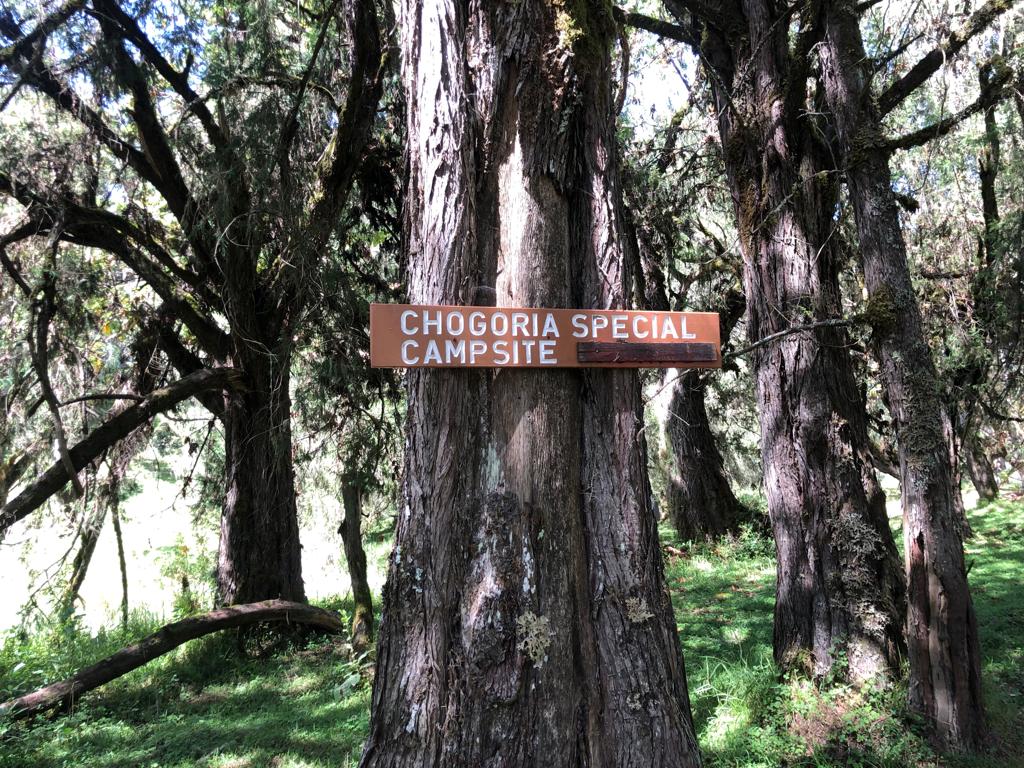
From Chogoria gate, we followed the rough road through a small stream and into a forested area. This is the only part of the trail with vegetation and protection from the sun. It also has these signs for those thinking of camping, and to encourage the hikers to proceed to Lake Ellis.
Watch the Video on YouTube
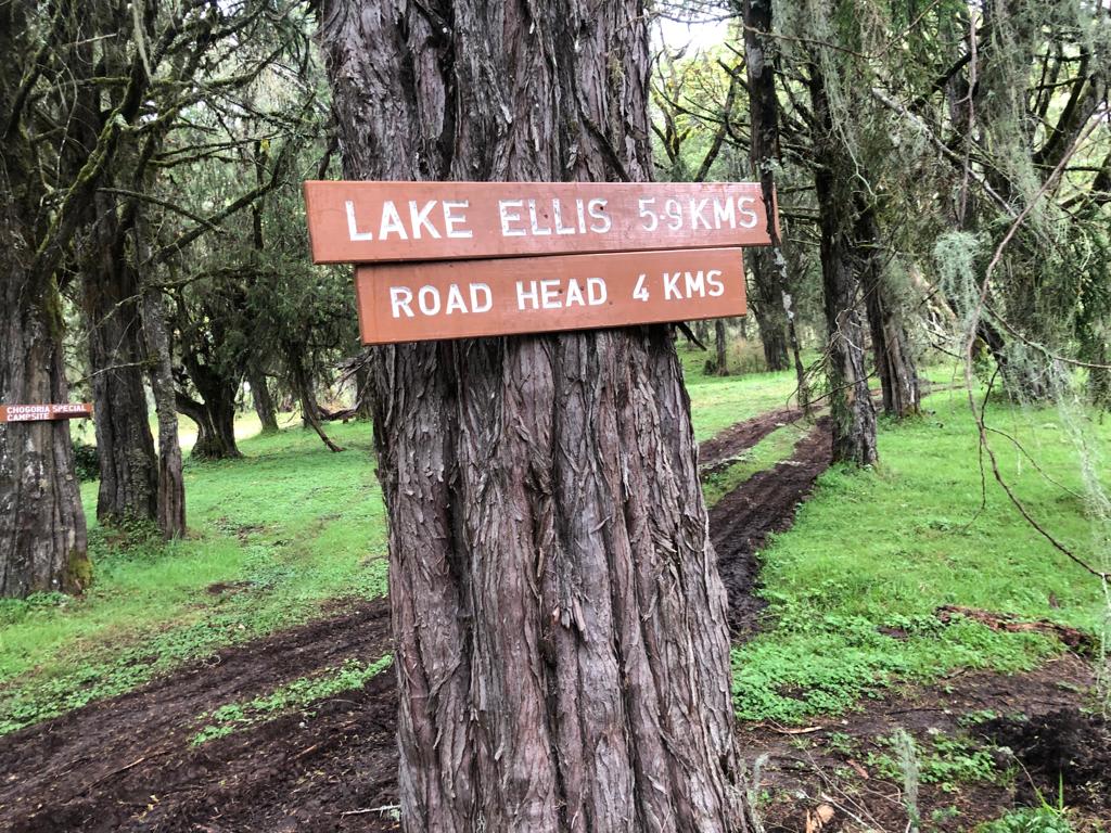
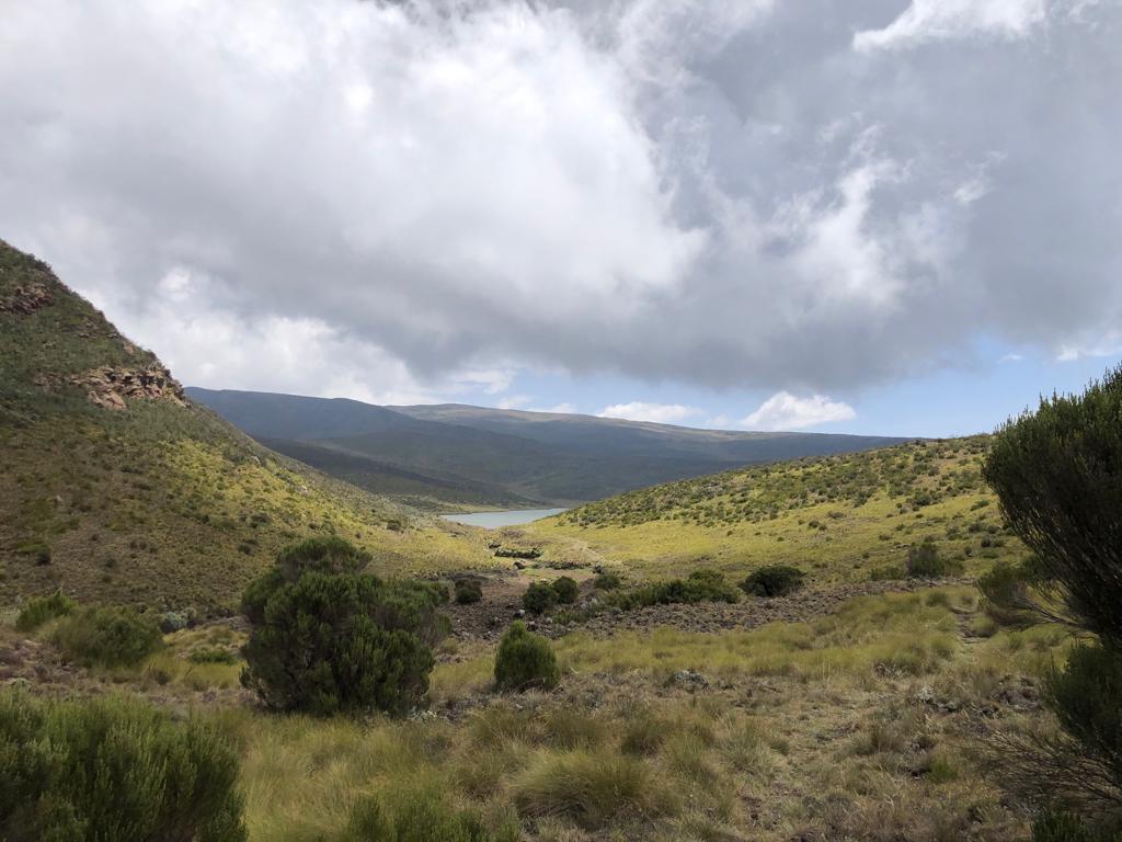
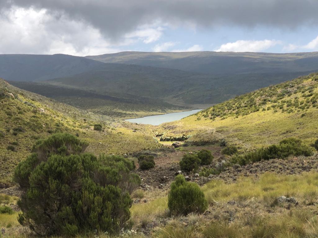
Past this forested small patch, the trail is an all-weather road. When rounding off the last bend, you can see the lake from a distance. Instead of continuing with the rough road, follow the trail through the thickets to the lake as it’s a shorter route than continuing with the car trail.
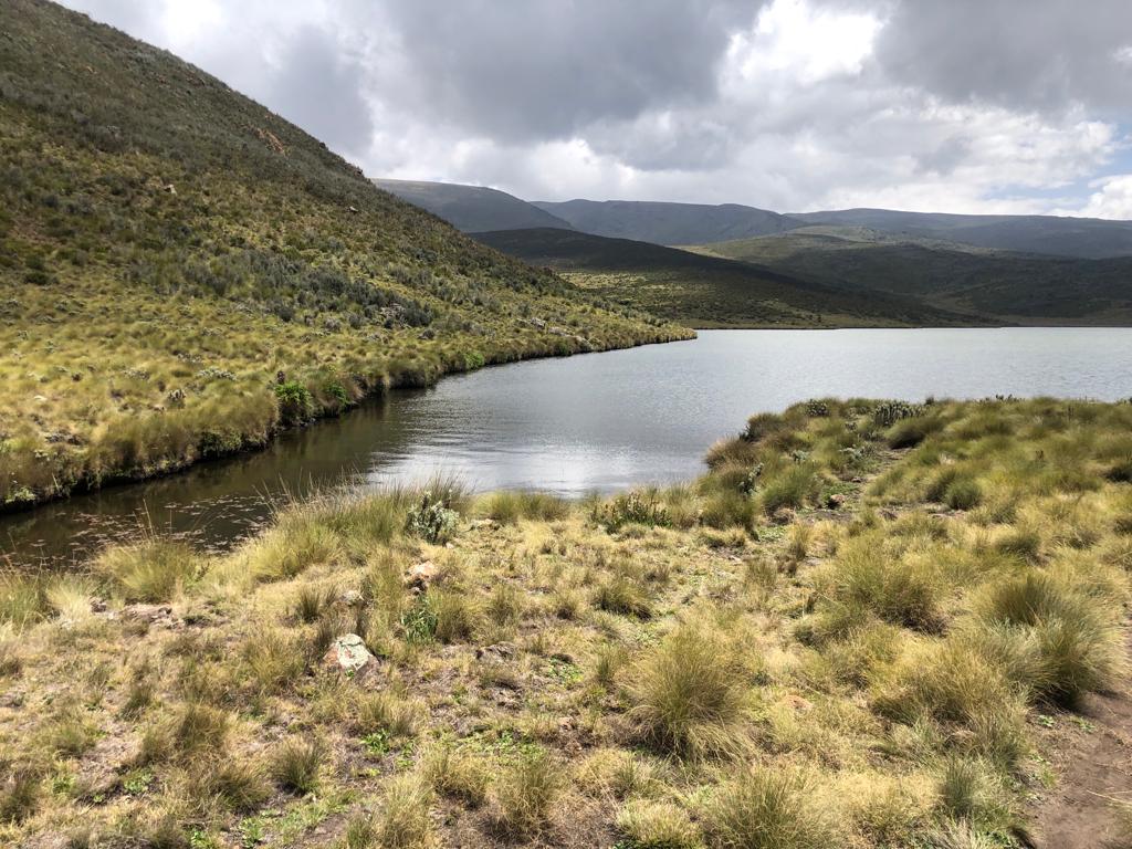
Lake Ellis is situated below Mugi Hill and is the 3rd largest lake in Mt Kenya at 28 acres. Mugi hill was the sign of how far or close enough you were to see the lake.
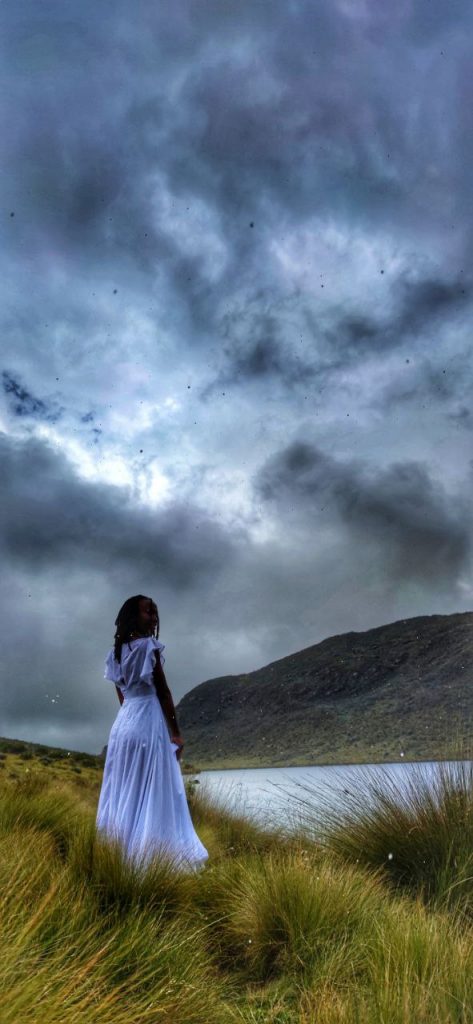
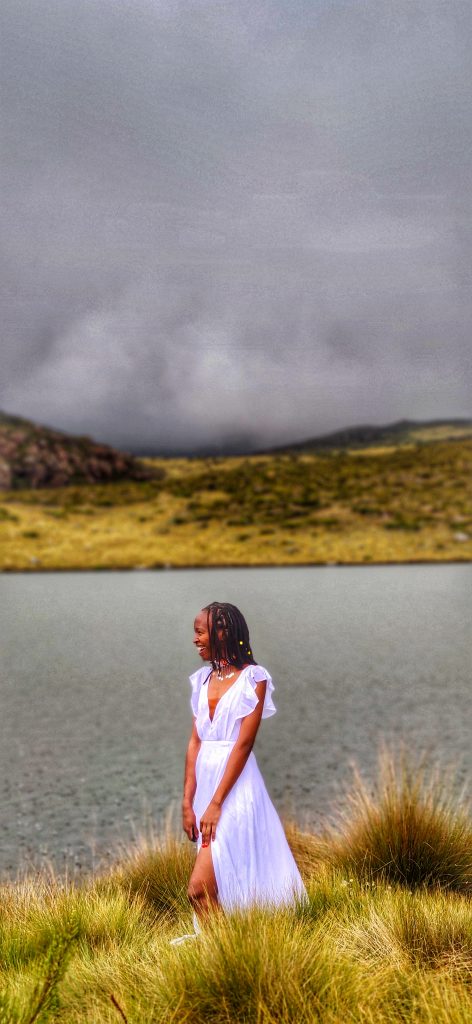
Photoshoot at Lake Ellis
While the hike to Lake Ellis was in the midst of scorching weather, Lake Ellis is very cold and breezy.
Be prepared to layer up and layer down as the weather changes. It was super cold when we got to the lake and then it started raining after 45 minutes. We had a photoshoot with Monica and the girls in the midst of a hail storm! Let me know if these pictures are not giving Khaleesi, mother of the Dragons.
Lake Ellis Mt Kenya Hike: Frequently Asked Questions
What’s Lake Ellis Altitude
3,455M ASL. From the highway to Chogoria gate is quite a distance and you’ll use a vehicle through a murram road which is under construction. This takes you to Chogoria gate which stands at 2,950M.
In which country is Mount Kenya?
Kenya, East Africa.
Where is Lake Ellis, Kenya?
Mount Kenya can be accessed through the Chogoria gate.
How many lakes are in Mt Kenya?
There are 28 lakes, the list can be found here.
How high is Lake Ellis?
3,455M ASL
Here are a few more posts you may like:
Mt Kenya Summit: Hiking Through Sirimon Gate to Lenana Peak
20 Things You Should Know Before Hiking Mt Kenya
10 Must Visit Restaurants in Watamu
Sorry, the comment form is closed at this time.
Pingback: Lake Ellis, Mt Kenya Day Hike. In Dresses, We Were Rained On by Hailstones. - Themkare.com
Pingback: Micro spikes for Hiking: How to Choose the Right Micro Spikes for Your Next Hike